PhD Year 1
During the first few months of my PhD I began networking within the university department at monthly research group meetings, 1st year training, and seminars, and with students from other universities across the IAPETUS DTP at two external training weeks in Durham. My work focussed on a literature review, identifying research gaps, and drafting my chapter questions. I also engaged with teaching, working as a demonstrator on an undergraduate GIS course, to help students during lab work.
Research Assistant job Glasgow university
DI contributed to a publication which modelled the projected sea level rise up to the year 2300, across south-east Scotland from Fife to the Scottish Borders. My work involved mapping recent changes in salt marsh health and extent, and quantifying coastal assets at risk of inundation from projected sea level rise.
I also contributed work to another publication during my research assistant job. This involved calculating sand volumes in ArcGIS mapping software, to recommend the amount of sand needed for dune nourishment at Montrose beach. This work was commissioned in collaboration with Angus council, with the aim of building resilience of the beach dunes in order to protect the town of Montrose from coastal flooding.
MSc Dissertation (2024)
For my MSc dissertation I created a landslide susceptibility map of one of the most landslide prone regions of Italy, Vernazza Town in Cinque Terre. To create this high resolution map shown below, I decided to undertake fieldwork in the region, where I took photographs with my DJI Mini 2 drone. This allowed me to map the hydrology, topography, and land use of the area, to then create a multi-criteria landslide susceptibility model (LSM).
MSc work (2023/24)
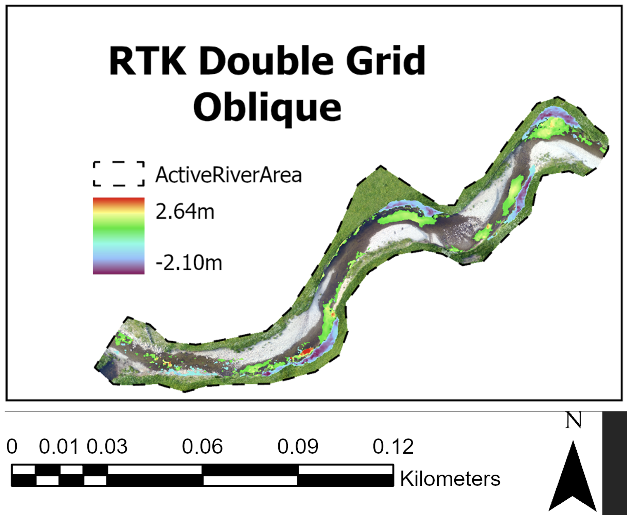
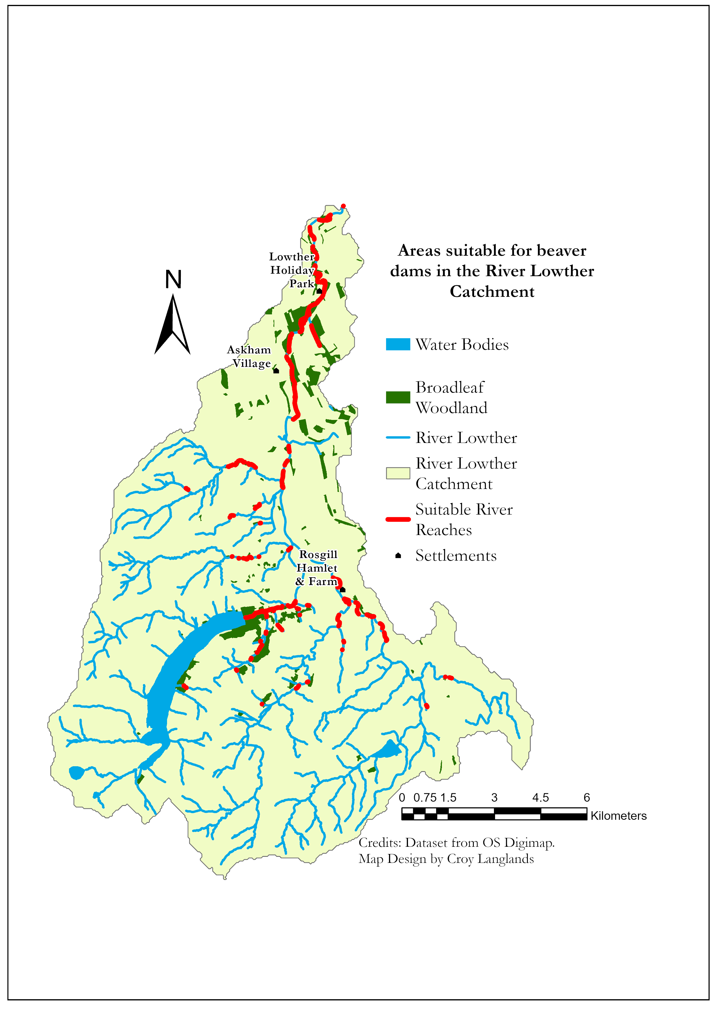
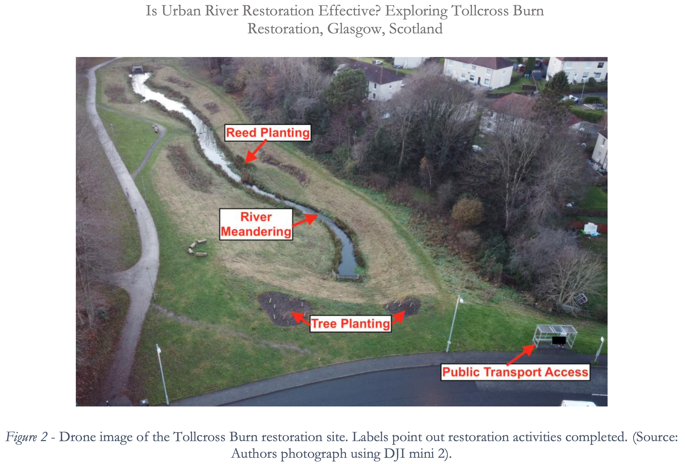
I continued to advance my skills in mapping and research, during my MSc in Environmental Sustainability at the University of Glasgow. Below are examples of some of the projects I worked on during my masters degree year. Firstly, a poster informing the public on the benefits of a river restoration initiative. Secondly, using advanced mapping skills I undertook geomorphic change analysis, outputting this figure, showing areas of loss and gain of sediment before and after the river restoration. This work is essential to accurate river monitoring. Thirdly, mapping suitable areas for beaver restoration. The forth image is taken from an essay where I discussed the benefits of unearthing urban rivers from underground pipes. Lastly, a web map I made from code, showing the Geography of health inequalities in Glasgow.


Bsc Dissertation (2023)
Drone mapping supported my BSc (Hons) dissertation which investigated how climate change impacts tree growth in Scotland. Particularly DEM and density mapping allowed analysis of environmental tree growth impacts. Findings were applied into a discussion on improving climate resilience in woodlands.
I created one of the first multi-criteria tranquility maps of Loch Lomond National Park. Findings were used to propose routes for new hiking paths which accommodated different needs (accessibility, tranquility, and openness). Skills were developed in spatial analysis, creativity, and National Park Management. This project was published in the Elphinstone Review Journal in 2023.


Plant succession in the alps (2022)
Group fieldwork in the Italian Alps, investigating plant succession on a recently deglaciated and dynamic alpine environment. The plot shows plant grouping at different altitudes, suggesting plant adaptations and the suitability of species to different conditions. This is useful to understand in this rapidly changing landscape driven by climate change.
")
Locations of transects, where vegetation surveys were conducted to record species growing in different areas of the recently deglaciated Alpine environment.

Non-metric multidimensional scaling (NMDS), was used to group plant communities, to help establish a chrono sequence. This data is based on primary data collected during vegetation surveys in the Italian Alps.